


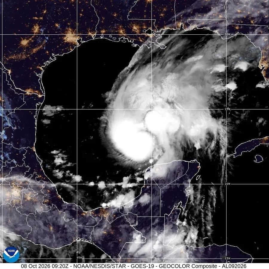

This satellite image from the National Oceanic and Atmospheric Administration shows Hurricane Isaias in the Gulf of Mexico, Thursday, Oct. 8, 2026. (National Oceanic and Atmospheric Administration via AP)
Associated Press
Hurricane Isaias has formed and is now starting to make the turn towards the United States. It is one of the latest-forming first hurricanes in recorded history of the Atlantic basin. Here’s what you need to know about the storm if you are in the Gulf region and the Southeast.
Expected track of Hurricane Isaias.
NOAA and NWS
What To Know Right Now About Hurricane Isaias
Hurricane Isaias continues to intensify as it makes the turn towards the United States. Located just northwest of the Yucatan Peninsula, Isaias is a Category 1 hurricane with maximum sustained winds of 80 miles per hour. It is in a somewhat favorable environment for strengthening, so I would not be surprised to see it intensify to a Category 2 or 3 storm before landfall.
“Because the shear is not forecast to increase
appreciably for the next 24 hours, and because the hurricane has been
intensifying despite the shear, significant intensification is still
shown in the short-term, making Isaias just shy of major hurricane
intensity in 24 hours,” wrote NHC forecasters. I am keeping a close eye on the intensity changes. They can be more difficult than track forecasting.
Peak storm surge forecast.
NOAA and NWS
As it gets closer to landfall, it may encounter wind shear conditions that could limit or even reduce its intensity. Powerful Hurricane Michael (2018) strengthened despite significant wind shear being present in the atmosphere. My hurricane senses always “tingle” these days given the extremely warm waters this generation of storms traverse “Regardless, Isaias is expected to remain a dangerous hurricane through landfall, and gusty winds are expected well inland after landfall given the anticipated expansion of the wind field and accelerating forward speed of the storm,” warned NHC meteorologists. This will be a significant storm event with life-threatening storm surge, flood-producing rainfall, intense winds, and the threat of tornadoes. The wind, storm surge, and tornado risks are often greater to the right of the center of the storm.
A Hurricane Warning is now in effect from Ocean Springs, Mississippi to the Bay/Gulf County Line in Florida.
A Tropical Storm Warning is in effect for Jefferson/Plaquemines Parish Line, Louisiana to Ocean Springs, Mississippi. Hurricanes are not lines or dots on a map so impacts should be expected well beyond the storm and inland.
Severe weather threat.
NOAA SPC
Inland Threats And Impacts
The storm is expected to make landfall near or just to the east of Mobile Bay in Alabama late Friday evening or early Saturday morning. That means a very wet and windy start to the weekend in the Southeast. Many college administrators and the NCAA are watching closely as well. Several major football games could be impacted by Hurricane Isaias. However, the expected speed of the storm could bode well for games slated for later in the evening like the Georgia – Alabama game. However, windy and raining conditions could still linger. Nearly half a foot of rain could fall along the northern Gulf Coast and in some spots inland. Significant rainfall could affect Georgia, Alabama, Mississippi, and even the Carolinas.
One unsung impact of Hurricane Isaias may be related to gas prices. The storm is moving through the Gulf, which is dotted with oil or gas platforms. They are often evacuated when storms move through the region, which can temporarily limit domestic supply.
Historical Context Of The Storm
El Nino, as expected, limited hurricane activity in the Atlantic basin this year. But this has been a record suppression. “Isaias will be one for the record books, as it may become the first hurricane to form so late in the season in the Atlantic Basin (including the Gulf and Caribbean),” wrote meteorologist Brian Lamarre on Facebook yesterday. “October 8, 1905 is currently the latest date on record for the first hurricane formation in a given year,” He continued. With the formation of Hurricane Isaias, it will certainly take its place in history as one of the latest forming Atlantic basin hurricanes.
Rainfall Forecast.
NOAA and NWS
















Leave a comment